Sustainable tourism tax funds underwater atlas: a cartography of Posidonia Oceanica
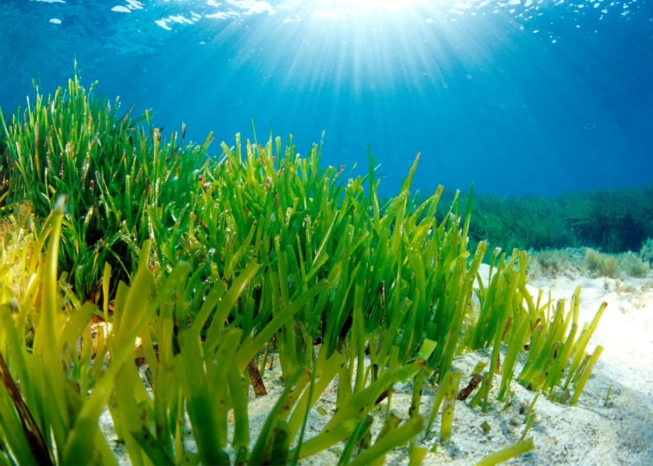 Pradera de Posidonia oceanica en Formentera.
pradera de Posidonia donde hemos encontrado los organismos más longevos del planeta, clones de Posidonia de cerca de 100,000 años de edad.
Pradera de Posidonia oceanica en Formentera.
pradera de Posidonia donde hemos encontrado los organismos más longevos del planeta, clones de Posidonia de cerca de 100,000 años de edad.
The Balearic Islands Government has unveiled ‘Underwater Atlas: a cartography of the Posidonia Oceanica’ in the Balearic Islands. The project, fully financed with funds of the sustainable tourism tax, aims to complete the existing cartography of the Posidonia Oceanica to protect the unique seagrass growing around the coast, said to be a vital source of oxygen in these waters. The project is accompanied by the development of a new app that will be launching in May 2020, allowing users to know if they are in a permitted anchoring area (and indicating no-anchorage zones for boating vessels).
The Posidonia Oceanica is an oceanic marine plant that is vital to the local ecosystem. It can only be found in the Mediterranean on sandy substrates at a depth of 35-40 metres. It is sensitive to coastal activity and has decreased in size due to human activity. The new campaign aims to conserve the Posidonia meadows to protect the unique ecosystem and the quality of the water, allowing the islands to remain a sustainable tourist destination for years to come.
“We are truly proud to showcase this project,” says Miquel Mir, Balearic Islands’ Minister for the Environment. “It represents a new milestone in the conservation of the Posidonia Oceanica, and is a necessary action to ensure the long-term preservation of our marine biology especially given the nautical activity in and around the Balearic Islands. The cartography will also become a vital tool for the scientific study of this marine plant.”
Earlier this year, the Balearic Islands’ Environment Department, carried out a cartographic analysis which outlined important discrepancies in existing underwater maps, outlining deficiencies of the Posidonia, particularly in Mallorca, paving the way for the next stage of this initiative.
Thanks to the sustainable tourism tax, the Balearic Islands Regional Government for the Environment was able to acquire a side scan sonar, used to efficiently create an image of large areas of the seafloor with which the distribution of Posidonia meadow will be studied and the cartography will be developed.
A cartography of the seafloor will be carried out in Mallorca, except in those areas where there is reliable evidence that the habitat does not exist. It is estimated that this will cover an area of 356 km2. In the rest of the Balearic Islands (Menorca, Ibiza and Formentera) it will be necessary to conduct surveys to validate the results and assess the most appropriate next steps. The total investment for this project is €770,000.
Since the first year of the sustainable tourism tax in 2016, 340 million euros has been channelled into 225 sustainable tourism initiatives on the islands of Mallorca, Menorca, Ibiza and Formentera. This has enabled the government to make major investments to reduce the negative impact of tourism, so it can remain a sustainable tourist destination for years to come.