
Orca expands chart coverage to Canada
Norwegian marine tech startup Orca, which develops marine co-pilot and navigation systems, has expanded its chart coverage in the Americas to cover the Canadian coastline and the Great Lakes. Orca’s navigation system is now available across the US and Canada.
The Canadian updates to the chart coverage will be available to all Orca app users, with immediate integration into Orca’s suite of planning and navigation tools. Orca says this latest launch will give Orca boaters the freedom to move between the two nations’ borders for the first time. The launch is bringing Orca one step closer to delivering its global chart coverage target.
“Canadian boaters have been asking for us to launch in Canada since the day we announced Orca,” says Kristian Fallrø, co-founder of Orca. “We’ve even had boaters order their Orca to the US and drive across the border to get early access.”
Orca is a navigation system for sailboats and powerboats that launched in 2021. The system consists of the free Orca mobile app for iOS and Android devices — Orca Display 2, a marine-grade tablet — and Orca Core 2, a smart navigation hub that integrates with the boat’s sensors and instruments.
Orca features smart systems such as automatic routing, sail routing, weather forecasts, and AIS via the internet.
“This release is not only important for Canadian boaters but also for US boaters who boat at the borders of Canada,” says Jorge Sevillano, co-founder and CEO of Orca. “As always, when we extend our chart coverage, existing Orca subscribers will receive access to Canadian charts free of charge.”
Orca’s charts are built on data from hydrographic offices, private entities, and in-house data collection. Canadian chart coverage is courtesy of the Canadian Hydrographic Service.
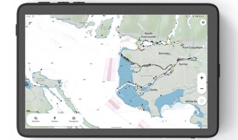
Main image of the Orca Display 2 with charts of Vancouver courtesy of Orca.