Garmin launches MSC 10 marine satellite compass
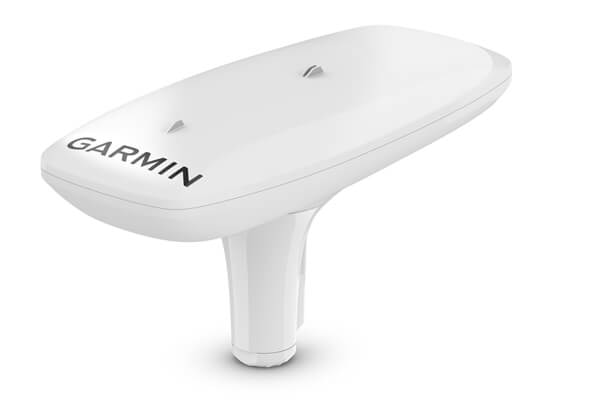
Garmin® has launched its MSC™ 10 marine satellite compass with multi-band GNSS and a fully integrated attitude and heading reference system which it says offers a smooth and accurate GPS-derived heading and position on the water.
“Garmin was the first to deliver a marine positioning receiver and antenna utilising multi-band GNSS support, and we’re pleased to continue to bring this innovative technology to our customers with the MSC 10 satellite compass,” says Dan Bartel, Garmin vice president of worldwide sales. “An advanced navigation tool, the GPS-based MSC 10 won’t be impacted by magnetic interference, so even in challenging situations, you’ll know exactly where you’re headed.”
Utilising both L1 and L5 GPS frequencies, along with multi-constellation support (GPS, Galileo1, GLONASS and BeiDou), Garmin says the MSC 10 will provide precise positioning and heading accuracy within two degrees. Its 10Hz position update rate is said to deliver better, more detailed tracking information. The MSC 10 also uses satellite signals which eliminate magnetic interference that can degrade heading accuracy.
Easy to install, the MSC 10 can be used as the primary position and heading sensor across multiple systems, including autopilots. Along with heading, Garmin says the MSC 10 is will deliver reliable, precise pitch, roll and heave information – even in rough seas – straight to a compatible Garmin chartplotter via the NMEA 2000® network. In the rare case that satellite signal is lost, it will transition from GPS-based to a backup magnetometer-based heading.
NMEA 2000 certified, the MSC 10 is compatible with a range of Garmin chartplotters, including the GPSMAP® 8400/8600 series, the new GPSMAP 7×3/9×3/12×3 series, and the keyed GPSMAP 10×2/12×2 series. The MSC 10 is expected to be available in May 2021 for a suggested retail price of £899.99.